One of my favorite times to visit the Oregon Coast is during the winter. With incredible whale watching opportunities, winter wind storms, and King Tides bringing huge waves- there is lot of drama on the Oregon Coast to enjoy in the winter.
Close up of sea foam
Winter also brings increased amounts of white (sometimes brownish), billowing suds from the ocean to collect on our sandy beaches. Sea foam is not just a winter phenomenon, but it is the time of year that it does seem to pile up. So, a couple weekends ago, when I found myself on a hike on the beach enjoying the sun and waves (yes! Sun in February), I found myself face to face with a lot of this surf riding fluff.
The Hike
View from Hobbit Beach Trail heading toward Heceta Head
The Hike at a Glance
Trailhead: Hobbit Trail Trailhead (turnout on Highway 101 a little north of Heceta Head)
Miles: 1 mile round trip to the beach. 4 miles round trip to Heceta Head
Elevation Gain: almost 1000 ft
Notes: Trailhead can fill up easily on a nice day. There is no restroom at the trailhead. Trail is well signed and easy to follow.
Foam Fairy Tales
I grew up a Disney kid. I saw all of the movies, including The Little Mermaid. In fact, it was one of my favorites. I loved to sing the songs and dream of adventure, just like Ariel. Of course as an adult, I can see a lot of flaws in the timeless tale, but I digress. Anyway, later in my childhood, I was also exposed to the original story of The Little Mermaid by Hans Christian Anderson. A much darker tail where Ariel is rejected by the prince, dies, and turns into sea foam. Though Hans, when he wrote The Little Mermaid didn’t know it, his depiction of the death of sea life turning into foam is not terribly inaccurate.
Good Foam
Sea foam at Hobbit Beach
Sea foam is dissolved organic matter that has been churned up by the sea creating suds much, like washing detergent suds up when agitated. More agitation means more bubbles. Thus, in the winter, when there is more churning of the ocean, we often see more sea foam. But where did all these organics come from?
The dissolved organic matter that creates sea foam is mostly natural occurring. Ocean water is made of a lot of materials- salts, fats, proteins, and all sorts of particulates. All of these things have the potential to create bubbles when you shake them up. However, according to NOAA, one of the most common causes of thick piles of sea foam is dead algae.
When algae growth is high in the ocean, a lot more of it dies and ends up washed up on the beaches in sea foam. This is a good sign. Algae are producers – the base of the ocean food web- they transform sunlight and inorganic chemicals (carbon dioxide and water) through a fancy biochemical reaction into food and oxygen. A lot of dead algae means a lot of living algae available as food for ocean life.
Sea foam piled up on Hobbit Beach
Not So Good Foam
Of course it should be noted that algae blooms have the potential to be harmful. They can form toxins and other compounds that may be bad for people and wildlife. For example, in 2007 a harmful foam formed from algae called Akashiwo sanguinea on the west coast. The protein surfactants from the algae, in this case, stripped the natural waterproofing off the feathers of sea birds leading to hypothermia and death. Will we see more cases like this in the future? It is hard to tell.
It seems there is still much to learn about the foamy stuff. There are even some ideas floating around about using sea foam to increase the albedo (reflectivity of sunlight) of the ocean in order to limit global warming.
Pretty Good Foam
So for now, just enjoy watching sea foam pile up creating a beach wide winter bubble bath. Despite the fact that it contains the remains of living creatures, it is a better indicator of life than death. Besides, it sure is pretty to look at.
Ah, snow— tiny frozen ice crystals falling from the sky. Snow is amazing— chillingly beautiful and fun to play in. Great for skiing, snowshoeing, sledding, and don’t forget building snowmen. But most of the world’s snow is ephemeral. It is like a holiday, or romantic tryst—magical at the moment but doesn’t last.
However, it is the ephemeral nature of snow that perhaps makes it so vital. The fact that snow hangs out for a while on the landscape is one of the most important features of snow. How snow accumulates, shifts and changes form, and eventually melts away, significantly influences the ecology, hydrology, and natural resources of the land.
Change
Christina Aragon on the top of Potato Hill.
While snow is a great influencer, it is also greatly influenced. From its start as a snowflake falling from the sky, its fate depends on a host of environmental factors. Just a little nudge in temperature, or a small shift in humidity, and snow will change. It may fall as sleet, or turn into rain. It may not accumulate or melt early.
Concerns around changing snow, brought me to reach out to Christina Aragon, snow hydrologist and Ph.D. student at Oregon State University. After seeing her speak at a TapTalk in early February 2020, I HAD to see if she would be up for a snowshoe with me. She agreed. And before the month was up, we headed into the Cascade Mountains to find some snow.
The Hike
Trailhead: Potato Hill Sno-park
Distance: 3.5 miles, with a possible 5+ mile loop option by adding the forested Hash Brown Loop.
Elevation Gain: about 800 feet
Notes: Sno-pass is required for parking. There is no restroom at the trailhead. The parking lot is not huge. Snowshoe route follows Jack Pine Road. The elevation is 4,200 feet.
Special as a Snowflake
We arrived at the Potato Hill Sno-park late in the morning. The snow was falling as we strapped into our gear. It was still falling as Christina and I began our steep ascent through the white and drifted snow.
We had gone no more than a few 100 yards when Christina wistfully reached out and caught a few snowflakes on her glove. I leaned in closer to have a look. Christina explained as I tried to make the details in the tiny crystals on her glove that, though each snowflake is unique, snowflakes can be classified by their shape.
Different snowflake shapes will form depending on the temperature and relative humidity in the atmosphere. The snowflakes that were falling while we headed up potato hill were mostly clusters of needles. Needles, which look a lot like their namesake, form when the temperature is relatively warmer and humidity is at mid-range.
Christina also caught a stellar dendrite in flight, but it quickly melted into her glove.
Stellar dendrites look more like a classic snowflake- flat with six intricate lace arms coming out from a center. Stellar dendrites will form when humidity is higher and temperatures are a bit warmer, or if the humidity is really high, but temperatures are cold. (They also form when you combine a six-year-old with a white piece of paper and scissors, but I digress.)
Several different snowflakes can fall at one time, but usually, one type predominates.
Other snowflake shapes include columns, capped columns, and six-sided plates.
Also, keep in mind snowflakes are small, defined as a single crystal. If you are looking out the window at what appear to be large fluffy snowflakes, these are actually clumps of snowflakes falling together. This occurs when flakes fall and start to warm up, melting into each other.
What’s the Graupel?
Not all ice falling from the sky is snow or made up of snowflakes.
Graupel is another form of falling ice crystals. Graupel forms when a falling snowflake collects supercooled water droplets on its surface forming a large (2-5 cm) rounded pellet. Though not a snowflake, graupel is a type of snow.
In contrast, sleet is not snow because, though it may start as snow, it melts and refreezes into ice.
Who knew that just defining snow would be so complicated?
A slice of snow cake
Christina digging a snow pit.
Up the tree-lined road, we continued walking along what felt to me like very stable snow.
Just a couple of weeks ago, I had been snowshoeing through snow that was very unstable. That got me wondering—Why was that? What happens to snow once it reaches the ground? Why was the snow today such a pleasure to walk on compared to before? I asked Christina for the skinny on-ground snow.
Once the snow falls to the ground, like a caterpillar in a chrysalis, it begins to undergo metamorphosis (though the change is less predictable than you get with a monarch). The best way to see these changes is to dig in and look at the layers.
Digging a snow pit reveals a snow profile. A snow profile serves as a record of events in the “life history” of the snowpack. It can also help you determine its stage of metamorphosis—is it becoming more or less stable, for example? So that is what we did.
Our snow profile revealed fairly stable snowpack conditions. By running a finger or two through, and into, the snow layers, we were able to identify a softer “new snow layer” and a deeper layer of very “stable rounds”.
Snow profile testing.
Rounds or Facets
Rounds dug from the lower portion of the snow profile.
New snow layers still retain some of their original crystalline shapes and are less dense. While deeper in the snow, either rounds or facets will form depending on the temperature gradient.
Rounds form in snowpack when the temperature range through the snow is pretty similar throughout the snowpack, or isothermal. When the temperature gradient has more than a 1 ° C change for every 10 cm of the snowpack, this is a sign that facets are forming.
Facets are unstable and can lead to avalanche danger. Unlike rounds that have sinters that hold the snow together, facets are large and angular with points and don’t stick together well. Imagine “sticking your finger into sugar” and that is kind of like what facets feel like, explained Christina.
Rain Crusts
In addition to the two main layers, our finger test revealed a small rain crust in our snow profile. Rain on snow is a source of latent energy, as the liquid water freezes on the snow, energy is released into the snowpack.
A rain crust can also change the movement of water through the snow. Instead of water flowing vertically through the snowpack and into the soil below, water can flow horizontally through the snowpack along the ice layer.
One of these Snow is not like the Others
In the Cascade Mountains, having a stable snowpack is actually the norm compared to other places in the U.S. Snowpacks in maritime snow climates, like the Oregon Cascades, generally form right at freezing temperatures, building deep, dense, wet snowpacks. In continental mountain ranges, like the Rockies, temperatures are much colder, and the air is much drier creating a shallow, less dense snowpack. Think fluffy “champagne powder.”
The maritime climate of Oregon’s Cascades results, not only in relatively warmer, but much deeper and denser snowpack. Warm moist air is carried inland from the west, sometimes on huge atmospheric rivers, and pushed up over the Cascade Mountains- this is called orographic lift. The result is that as this air rises, it cools, and the moisture is squeezed out as rain or snow.
Losing Structure
The unstable snowpack I experienced a few weeks ago, was probably due to a loss of structure that can occur with mid-season melt (another very Oregonian snow predicament). In this case, mid-season melt probably caused most of the sinters that hold the rounded snow together to melt away. The remaining snow was more like a loose collection of rounded pebbles of ice with very little strength.
Snow on Fire
The transition from forest to burn area.
Nearing the top of Potato Hill, the scenery changed from snow-covered trees to more open terrain. The B&B Complex fire of 2003 burnt down much of the forest in this area.
Observing snow in burnt forest areas, was one of the ways Christina first became interested in studying snow. In B.C., when one of her favorite forested snow recreation areas was burnt, she noticed that the snowpack was gone MUCH earlier than before the fire. Christina was later able to work with Dr. Kelly Gleason on a research project that explained the phenomenon.
Black Snow
Burnt trees from B&B Complex fire.
We hiked up to one of the burnt trees on Potato Hill where Christina pointed out its charred bark. She explained how black carbon and micro-charcoal particles from trees and other sources end up in the snow following a burn.
Snow normally is very reflective of the sun’s rays—it has a high albedo. However, as dark particles accumulate on snow’s reflective surface, instead of bouncing back, the rays get absorbed by the black carbon, heating up and melting the snow!
We dug into the snow to see if we could see the particulates in the snow on Potato Hill. Despite the fire being over 10 years ago, the snow still looked dirty with particulates.
Snow profile taken in burned area.
More Melt
However, black snow is only one factor that affects snowmelt in the west. Climate change is causing shifts in both the quantity and timing of snowfall in the western United States. Many places in the west are already seeing a decline in snowpack and a shift to earlier spring snowmelt, trends that are expected to continue.
This is a huge problem! Snow is a reservoir for our water supply—storing water for later in the year when we need it. In the western U.S., about 70% of our runoff originates with snow. With the timing of snowmelt shifting to earlier in the year, runoff is making it into our valleys too soon, and we don’t have the supply we need for later in the year.
A Vicious Cycle
Less snow means less reflection of light from the sun (lower albedo), which means more heat absorption and more melting—a vicious cycle.
Earlier melting of snow also results in dryer forest soil in the summer and a longer fire season, which means more black snow and more melting. Another vicious cycle. To make matters worse, the effects of black carbon on snow are not short-lived either—lasting 10 years or more.
Snow Measurement
Break at the summit- what a view!
Pelted by crystalline water droplets, Christina and I reached a “viewpoint.” Here we stopped to celebrate with pictures and a snow depth measurement.
A big part of Christina’s Ph.D. work involves improving models of snow distribution in mountainous and remote places in order to better understand water resource availability during the year. In order to do this work, good reliable snow data is needed. In particular, she needs to know the SWE of snow. SWE is snow water equivalent, the amount of water contained in the snowpack, and is based on snow depth x snow density.
Measuring SWE is not easy to do and involves heavy equipment that most people don’t want to carry in their packs. So instead of measuring SWE, Christina encourages and promotes a citizen science project called Community Snow Observations. Data gathered by the project is used to validate data gathered remotely and improve snow models. And the best part is it is easy. Using an avalanche probe, or even a ruler, you take several depth measurements, average them, and then report the value using an app.
Christina measuring snow depth.
Become a Citizen Scientist
Finding SWE from depth using both ground and remote sensing technologies is a hot area of research in the hydrology world. It is also research anyone can get involved in. If you want to do your part visit communitysnowobs.org to learn more.
Shifting Snow
On our way back down the hill to the car, Christina and I talked more about what to look for when in a snowpack environment.
The distribution and build-up of snow on the ground are always in flux, which can make it both extremely interesting to explore, as well as very complex and hazardous. Here are a few variables to consider while hiking in the snow.
Snow inception on trees.
Number 1- Trees.
The effects of trees on snowpack are complicated.
Trees can intercept snow, preventing it from reaching the ground where it accumulates, and increasing rates of sublimation, the direct transition of snow to water vapor. When branches of a tree are wide with low hanging branches, like most conifers this can also result in the formation of dangerous tree wells.
Trees also emit longwave radiation, like other dark objects, making the snow around trees slightly warmer than open areas, which may lead to more melting, particularly at the tree’s base. However, at the same time, forests block a lot of incoming solar radiation from reaching the forest floor, slowing down snowmelt in many forests.
Number 2- Wind.
The wind moves snow around a lot. Where the wind is going and coming from changes the profile of the snowpack—making it more shallow in some areas, and in others really deep and hazardous. Wind loaded slopes are a real avalanche danger that can occur on downward slopes where wind piles up snow. Wind scoured slopes, like the top of a peak, will have a shallow profile and can be difficult to travel on.
Number 3- Elevation
In general, the higher up you are in elevation the more snow will accumulate (with the exception of peaks scoured by high winds). Snow profiles deepen at high elevations and may present more layers. Thus, to understand the snowpack in an area, it is generally a good idea to dig snow pits at multiple elevations and locations.
Number 4- Aspect.
North-facing slopes receive less solar radiation than south-facing slopes. Even on a small scale, once the snowpack enters the ablation period, where it is melting off, south-slopes will melt off faster.
Number 5- Slope Angle.
One of the easiest factors to keep in mind when considering potential hazards in a snowpack area is the terrain. Steeper slopes are much more prone to avalanches. If your slope is between 20-25 degrees or less, your risk of avalanches drops significantly.
Let it Snow
Phew! That was a veritable blizzard of snow information! So don’t let it melt away. Instead, hit the snowshoe trail, catch some snowflakes, dig a snow pit or two, measure the snow, or simply watch the snowfall. And next time you take a shower or sip your favorite beverage, think about those cool white flakes. Because odds are, that liquid you are enjoying, first fell as snow!
Christina Aragon is a Ph.D. student at Oregon State University studying hydraulic modeling. Originally from Denver, Colorado, she has experience in avalanche operations and snowboarding. She got her undergraduate from the University of British Columbia where she studied kinesiology and ecology. She got her master’s in Geography from Portland State University where she studied hydro-climatology.
I love wildlife. Watching a bird on the wing or a deer bounding by makes me feel connected to, and appreciative of, the rich web of life on our planet. Wildlife encounters can also be a source of inspiration and awe. It can be a humbling experience to stand in the majesty of an animal’s presence.
However, with so many reports of negative wildlife encounters in recent years, with lives lost (both human and animal), the positive experiences of viewing wildlife are sometimes juxtaposed against a background of fear and uncertainty. The romanticized idea of wildlife and people living in harmony is exactly that- romanticized. By definition a wild animal IS wild and will behave as such.
Our Love will Survive
Nancy Taylor on the Calloway Creek Trail
As human populations grow and spread more into wild places, we are encroaching into the homes of our wild neighbors. So what can we do? How can we deal with our current situation?
As I headed to the trailhead to meet Nancy Taylor, ODFW Wildlife Biologist on Valentine’s Day (nonetheless), for a hike in the McDonald-Dunn forest, these questions remained at the front of my mind. Can people and wildlife ever find love again?
Perhaps I am a romantic, but I believe the answer to that question is YES! So grab some chocolate, or your preferred hiking aphrodisiac, and join me on a hike with a wildlife biologist.
The Hike
Hike at a Glance
Trailhead: Road 540 Trailhead (Parking area right off I-5, opposite ODFW offices)
Elevation Gain: 200 ft
Miles: 3 miles
Notes: Additional parking can be found at the Peavy Arboretum Trailhead. There are many options for adding mileage to the hike. The hike takes place in the McDonald-Dunn Forests, research forest for Oregon State University. This is a popular hiking area for locals. A Map of the trail system is available online.
Blurring the Line
From the trailhead, Nancy and I headed southwest into a Douglas-fir forest chatting about what it is like to work for ODFW as a wildlife biologist.
Nancy explained that her work entails a lot of public relations and outreach. Though her primary duties are with game animals, she is often dealing with reports of wildlife sightings and alerting the public of these sightings. It has become a large part of her job over the years.
One of the reasons we chose this hike, in particular, is because the McDonald-Dunn forest has become a mecca for wildlife encounters. The Calloway Creek hike is not in a remote area. In fact, part of the trail abuts a street of homes. Yet there are countless wildlife sighting made here and warning signs posted frequently at the trailheads.
Playing Games with my Heart
Wildlife encounters near cities with lots of green space, is not surprising. Forests provide many important wildlife needs, like food, water, and shelter.
I asked Nancy how the forest we were hiking through ranked when it comes to wildlife habitat. She said it was “not bad.” With a decent amount of browse, nuts and berries it should support species like deer and wild turkey.
However, though both of us had seen turkey on the trail in the past, neither of us had seen deer in the area before. Perhaps they found better forage in nearby backyards?
Deer game trail- spotted near the start of the hike.
In any event, it didn’t take long to spot a game trail (most likely from deer) running through the forest.
A game trail is a path created by an animal, like deer, through repeated use. Just like people, animals often follow particular paths through an area while they search for food. Even though you may not see the animal, you can gather signs that that were there. Game trails are easy to spot and can be fun to explore while on a hike, especially when the ground is soft enough to reveal the animal’s tracks.
Who are you?
Looking for tracks on another well established game trail.
On one of the game trails, Nancy and I spotted what looked like cat tracks- probably bobcat, based on their size. There were also tons of canine tracks. But they weren’t wolf or coyote- rather, domestic dog tracks. Which begs the question-Are dog tracks wildlife sign? What exactly is wildlife?
Wildlife is any non-domesticated animal- any bird, mammal, amphibian, or reptile that keeps house in the great outdoors is wildlife. Dogs, cats, cows, and most horses are NOT wildlife. But they can still be fun to look at.
Endless Love? Setting Limits.
I asked Nancy if there are certain wildlife species that are a priority for ODFW. She said that game species are the priority. Tracking elk and deer populations is necessary in order to set tag limits and manage game populations.
ODFW and other wildlife management agencies will conduct spotlight deer surveys where they drive around during certain times of the year counting animals at night when they are most active. For Elk, helicopter surveys are used for a count.
You may remember from high school Biology class that populations have a natural carrying capacity. Basically, wildlife populations are limited by their environment as resources are scarce and predators and other threats are an ever present problem. In the managed world we live in, carrying capacity has become culturally set- based on human needs and desires, as well as the health and well-being of the population. When it comes to managing wildlife populations, people are a huge part of the equation.
Roadkill
Another source of information for wildlife biologists on how wildlife is doing is roadkill. Sadly, another consequence of people moving through places that animals frequent is that they are far too often hit by cars. An Oregon law that went into effect January of 2019, makes it legal for anyone to salvage the meat of a deer or elk that was accidentally killed in a car collision . A permit must be filled with ODFW within 24 hours of when the animal is salvaged, and everything must be done according to specific guidelines. One such requirement is that the head and antlers must be turned into ODFW within 5 days of salvage. These heads then become a source of important information on wildlife for ODFW. Age can be determined by looking at the teeth of the animals. Other health conditions can also be examined.
Nancy told me she had just dissected an elk head that day to look for signs of chronic wasting disease (CWD). Caused by a prion- a misfolded protein that causes disease in the brains of animals (kinds of like mad cow), CWD creates holes in the brain tissues of elk, leading to strange behaviors, emaciation, loss of function, and even death. Though not in Oregon yet, this disease is devastating to elk populations in other areas of the country; and there is potential for spread into other animal populations as well, including humans, though no cases have been reported to date.
My Habitat is Better than yours
Continuing on our hike, we entered a couple of my favorite spots on this trail- 1) a mossy green riparian area dominated by big leaf maple trees and 2) an Oregon White Oak woodland further up-trail. As I paused to take in the beauty of each of these familiar spots, Nancy explained how valuable these places are for wildlife.
Riparian areas are incredibly important to wildlife, especially when you think of the disconnected landscapes that wildlife encounter with human roadways and development. Riparian areas act as natural corridors for animals to move about the landscape. They provide water and a food source for many organisms as well. Though they can make up less than 1% of the landscape, riparian areas are used by a lot of different species.
Entering the oak woodlands.
Oak woodlands are great because of their abundance of food. It is all about the nuts and berries! Wildlife signs were much more obvious and abundant when we crossed into this area. We saw holes in trees and multiple burrows with acorn shells scattered in their entryways.
Walk on by
Two invasive species found on the trail- Armenian Blackberry and shiny geranium.
As the trail looped back in the direction we came, we entered what looked like heavily impacted area. There were more invasive species, like Armenian blackberry, holly, and shining geranium, and the forest had less shrubs that would make good browse for deer. Invasive species, according to Nancy, are problematic for wildlife species for many reasons, they out-compete native vegetation that may be an important food source for some species, and invasives, like Armenian blackberry, can restrict movement for other species, like deer. Overall, invasive species impact on wildlife is mixed. What might not be a big deal, and perhaps help one species, can really cause problems for another.
Show ’em Some Love
As we were getting nearer to the end of the trail, I started thinking more about what might be done to resolve problems between animals and humans. I asked Nancy, what can people do to help wildlife?
With the biggest problems facing wildlife being habitat loss, Nancy recommended making this the focus.
There are many simple things people can do to get involved. Nancy suggested planting native plants that deer and elk can feed on, or putting up bird boxes, for example. Remove invasive species on your property, or get involved in a community invasive removal, or help with a native planting. Also, don’t feed wildlife directly. Dependency on humans for food is unhealthy for a wild animal.
You can also support laws and initiatives that put habitat conservation at the forefront of policy. According to Nancy, in Oregon there is a need for forestry policies that ensure better forest habitat. Nancy shared her concern regarding the loss of understory plants from plantation cuttings. Being involved in movements to improve forestry practices is another way to help on a larger scale.
Get to know ’em
More research into understanding population interactions and growth, especially for both our predatory species and game species, can also help. Understanding how animals move across the landscape through fragmented habitat can inform management decisions.
Wildlife corridors is another consideration, though an expensive one, for helping wildlife deal with our impingement into their range. At the same time, putting up fences to help keep animals off our own property can help prevent possible negative wildlife encounters.
Be Safe
Which brings me to another vital point. If we are going to rekindle our wildlife romance, we need to respect wildlife. Assume wildlife is around you, even if you don’t see it. Know what to do to be safe.
To put it in perspective, cougar populations are over 6,000 with a statewide range in Oregon. For safety, avoid being out alone during twilight hours and early morning, especially in areas that have good habitat nearby- and don’t run in these places. Even in a neighborhood setting, be alert and aware of your surroundings at times when cougars are active. If you do see a cougar, make yourself big. If you are attacked, fight back. And again, don’t run.
I’ll be Watching you
Just for fun- the octopus tree.
We didn’t see any cougar on the trail (though one may have seen us). However, not long before we made it back to the trailhead, movement in the trees overhead to our right caught my attention. Several birds flew across the trail, landing on some trees to the left, just ahead of where we stood. It was a varied thrush and brown creeper! This was our first and only wildlife sighting during the hike! The brown creeper entertained us for a moment by climbing up the tree trunk, while the varied thrush perched nearby showing its burnt-orange markings. Then, as quickly as they arrived, they were gone. There was no time to take a picture.
When on a trail, watching for movement, like that of our bird friends, is one of the best ways to spot wildlife. There are a lot of wildlife guides out there for those that want to identify birds or tracks/scat, but just paying attention to one’s surroundings, both sites and sounds, is a great way to start to find and appreciate wildlife. Evaluate the habitat potential for the places you frequent, as well, and be on alert in transition areas like the riparian forest or oak woodlands we saw earlier. Learn about what you might see and how this may change season to season. And if you really want to see wildlife, be out when wildlife are more active- within a few hours of dawn or sunset.
For the Love of Oregon
In the Pacific Northwest, there is no shortage of opportunities to view a variety of wildlife. Oregon has eight major ecoregions with unique flora and fauna due to its variable climate and soils. More habitat diversity means more wildlife diversity. Nancy recommends Cascade Head as a personal favorite hike for viewing wildlife- she once saw a giant pacific salamander on the trail! She also suggests heading toward the Cascade mountains for hiking. Canyon Creek Meadows is a beautiful hike near Three Fingered Jack that is recommended.
Signed, Sealed, Delivered
A pile of acorn shells outside a burrow entry way- anybody home?
So get out there and enjoy some wildlife. Pay attention to your surroundings and be safe. Notice the habitat that surrounds you and, if you are so inclined, help protect and restore it. It is a privilege to have natural places near our homes and workplaces (for Nancy, nearly a stone’s throw away from her work), but it is not our space alone. Show some love for wildlife this Valentine’s day month by giving to wildlife what it needs- a little more space to call home.
Nancy Taylor has 17 years of experience working for ODFW out of the Corvallis, OR Office. She has a B.S. in Biological Sciences from Cornell and a Masters in Coastal Ecology from Louisiana State University. Much of her education and background has focused on wetland ecology and habitat conservation.
Mountain beaver tunnel opening on Kentucky Falls Trail in Mapleton, OR
Signs of Life
Looking for wildlife signs along a trail is a great way to stay curious while hiking.
Lines of inquiry open up like, “Hey, what are all those holes in that tree over there?” “Look! I think I see a nest. What is it made out of? Is it active or abandoned?” “An animal track! What animal came through here? How recently did it pass by? Where is it headed?” And of course, “Why?”
Animal tracks in snow. Cone Peak trail in Central Cascades.
Burrows, holes, and dens are especially interesting to think about. Questions arise, like, “What made that?” “Where does it go?” “Does the organism that made it live there?” “Does it allow guests?” “What lives there now?”
Sign at Kentucky Falls Trailhead
So last weekend, after a long drive on forest service roads, I was excited to see a sign posted warning hikers about trail instability due to Mountain Beaver tunnels and dens at the Kentucky Falls Trailhead near Mapleton, OR. I had never heard of a Mountain Beaver (What the heck?) or seen (at least not with any idea of what I was looking at) its telltale signs. I had a lot of questions. But first, off to the hunt- a.k.a hike!
The Hike
The Hike at a Glance
Trailhead: Kentucky Falls Trailhead near Mapleton, OR
Miles: 4.4 miles
Elevation Gain: 700 feet
Notes: The drive to the trailhead is long and rough on many forest service roads. Google maps got us there with no problems. I recommend downloading an offline map of the area to help with navigation. In the winter, there is potential for snow on the road. A pit toilet is available at the trailhead.
Canopies and Cascades
Upper Kentucky Falls
The Kentucky Falls trail is a GORGEOUS hiking adventure with towering trees and waterfalls. Douglas-fir and Western Hemlock reach skyward all along the trail as you wind your way down to the first gushing waterfall- Upper Kentucky Falls. Moss covered rocks, sword fern, and plenty of other native herbs and forbs carpet the forest floor. The hike continues downward, over a bridge, and past the trail junction for the North Fork Smith River Trail and ends at the base of twin 100-foot waterfalls- Lower Kentucky Falls.
Curiouser and Curiouser
There were many interesting observations to make while hiking on this trail. The power and volume of the waterfalls, for example, raises questions about the size of the watershed and source of the water. Is it purely rainfed? I wonder how different it will look later in the year when things dry up.
Western red cedar snags as seen on the trail.
The structure of the forest also struck me. The Douglas-fir and western hemlock were tall and stately, but interspersed between them I saw dozens of short, decaying western red cedar snags. There has to be a story there too…
Down the Mountain Beaver Hole…
BUT I was on a mission… I needed to find signs of Mountain Beaver (Aplodontia rufa)! Where are the tunnels?
Several tunnel openings found along the edge of the trail
It didn’t take long, before I found what I was looking for.
The trail was saturated with several openings that looked like they would accommodate a small mammal, perhaps the size of a small rabbit or large gopher. It appeared the tunnels crisscrossed under the trail at unequal intervals, as there were holes heading into the embankment below and the trail above.
Depression in middle of trail- Mountain beaver damage?
At one point on the trail, it looked like an old tunnel system may have caved in leaving a large depression in the middle of the trail (I wish I had measured it!- darn!). Perhaps one of the tunnels had been large enough to act as a den, or there were too many tunnels crisscrossing that they all collapsed. Whatever had happened, it looked like an old occurrence, as nature was reclaiming the space.
As I reached the bridge crossing and started down toward lower Kentucky Falls, I didn’t notice the tunnel system anymore. Either I was too captivated by the rest of the surroundings to notice any tunnel openings, or they just weren’t in that area.
In any event, by the time I was back to the car and heading home, I had more questions than answers. I didn’t even know the basics, like “What the heck is a mountain beaver?” I was going to have to do some research to find out.
Mountain Beaver Basics
First things first, the name- Mountain Beaver- is a misnomer. Mountain beavers are not closely related to Oregon’s State Animal, the North American Beaver. They are more related to squirrels, if you need something to compare to. They are not really considered alpine animals either, as they prefer lower elevations in the Coast range and western Cascades, and have never been spotted above treeline.
Second, there is not a lot of information out there about the mountain beaver. For example, if you look up mountain beaver on the Oregon Department of Fish & Wildlife’s website you get a very brief description emphasizing the fact that it has a short nearly “invisible” tail. The blurb explains that the mountain beaver is a muskrat-like rodent with five toes and dark brown fur with white markings near its ears. Oh, and that it is found in the Oregon Coast Range. Literally, that is about it. Though the Washington Department of Fish & Wildlife was more helpful at providing details on the mountain beaver, in general, I found mountain beaver information rather limited and mostly focused on dealing with them as a pest species to timber operations.
Digging Deeper
However, “digging deep” into researching mountain beavers, I was able to make some sense of what I had seen and thought about while on the trail.
According to WDFW’s website, Mountain beaver tunnel openings are typically 6 to 8 inches in diameter, and tunnels can go as deep as 10 feet underground. Their tunnel systems are composed of several chambers that they use for different purposes like food storage, nesting, or a latrine. Mountain beaver are solitary mammals, as well as territorial. A single mountain beaver may occupy an area of 2 acres or more.
Despite my lack of x-ray vision, with opening after opening found along the trail, as well as the possible den collapse mentioned earlier (at least that is my hypothesis), there was plenty of evidence to support the idea that I was seeing an extensive mountain beaver tunnel system. In addition, the lack of tunnels I found as I moved further down the trail may be explained by the mountain beaver’s territorial nature- it is likely I had hit the boundary of a mountain beaver’s territory.
Habitat Needs
Like all of us, mountain beaver have needs. They need a lot of water to drink- requiring a ⅓ of their body weight in water daily- and vegetation, like ferns and tree seedlings, to eat. (They also feed on their own excrement, but that is another story…)
Small stream running across the trail.
Fortunately, water was very accessible on the trail; several very small streams ran across it.
Ferns clipped and piled in front of mountain beaver tunnel opening.
Food was equally available. And there were many signs along the trail that our rodent friend was partaking. You see, mountain beaver will clip food off from the base of plants- eating from the bottom up. Piles of clipped plants can sometimes be found temporarily stored outside a tunnel opening. Luckily, I was able to capture photo evidence of this phenomenon (see the picture above) – though admittedly by accident.
With a nearby water source and ample food, one thing is for sure, the Kentucky Falls trail provides perfect mountain beaver habitat!
Old is the New Young
Another fun fact about mountain beaver is they are old! On a geological scale they are ancient for a mammal. They are the only surviving members of the Aplodontia genus of rodents that has been around 35 million years!
However, despite their age, recent research done by Samantha Hopkins, from the University of Oregon, brings into question the long held belief that mountain beaver are primitive – existing as living fossils. Using fossil evidence, Hopkins found that “since they emerged as a species”, mountain beaver have gone through A LOT of changes- “their bodies have grown from the size of chipmunks to that of ground squirrels and then to marmots and muskrats.” Really, very little of what we now see in modern mountain beavers is primitive.
Clearly, there is more science to be done if we are to understand and appreciate this elusive rodent.
So, next time you are in the Coast Range of Oregon or the foothills of the Cascade, look around! Though you probably won’t see one, mountain beaver signs are hard to miss… when you know what you are looking for.
Soil! Sticky or grainy, soft or hard, wet or dry, dark or light… What is this stuff? Though it surrounds our everyday experiences, with so many different feels and forms, understanding soils can be a lot to keep track of… though remarkably easy to track through the house -cue my three kiddos. In addition to its varied qualities, soil is vital to our existence. Most of the food we eat is dependent on soil. Much of what dies, or is eliminated as waste, is broken down by soil biology. We build our homes on soil. We build our houses from the trees that take root in soil. Soil stores carbon…You get the idea.
So, when I hit the road to meet up with Marissa Theve, BLM soil scientist, for our hike at Cascade Head, I felt a flutter of anticipation. I was going to unlock the mysteries of soil, or at least get the scoop on this dirty little topic (pun intended).
With a rainbow overhead on the drive out to the Oregon Coast, it seems like a good omen. But you tell me. Join me on a hike with Marissa Theve- soil scientist.
Marissa Theve at the trailhead- ready to go!
The Hike
Hike at a Glance
Trailhead: Cascade Head Trail- South Trailhead. Knight Park.
Miles: 6.2 miles
Elevation Gain: 1,500 ft
Notes: Pit toilets are available at the trailhead. No dogs are allowed on the trail.
The Cascade Head Hike starts at Knight Park, just north of the Salmon River. In fact, the river is visible from the trailhead. And a part of what makes this particular hike so appealing are the views of the Salmon River Estuary experienced further up the trail. But I am getting ahead of myself…
What is soil?
Before we move on, we need to answer one little question- “What the heck is soil anyway?” Is the sediment at the bottom of the Salmon River soil? Is beach sand soil? Yes!!!
According to Marissa, soil “is a living habitat.” It is a diverse biome teaming with life forms, such as bacteria, nematodes, fungi, and plant roots. The interactions between all these organisms and their environment change the soil and aids in its formation. Though some soils may not be as developed as others- like a sandy beach- if they fit this general definition, they are in fact soils! O.K. back to the hike…
Turning our backs to the river, Marissa and I followed a muddy path that runs adjacent to Savage Rd and alongside a small stream.
Elk- soil construction or destruction?
Herd of Elk from trail
Before long we came to a clearing where a herd of Elk were grazing. A thought came to my mind- “Could the Elk be changing the soil?”
Soil compaction is one of the biggest impacts we see on Oregon soils. Compaction may occur anytime a large animal or machine or even a person exerts force on soil. Compaction is a problem because it changes the structure of soil. In general, we want soils that crumble like the crumbs of a cookie- this provides pore space for air and water, and habitat for soil organisms- which in turn makes the soil more fertile. Compaction destroys structure; compressing soil into sheets below its surface.
In addition, loss of vegetation through grazing, can also impact the soil by increasing erosion. Soil that is not covered by plants, or other materials, is susceptible to erosion by wind and water. The loss of the top layer of soil isn’t a huge deal on a hiking trail, but it is very problematic if you ever want to grow anything on the soil again. Topsoil, or A horizon, is the most important plant supporting part of soil.
Luckily, Elk herds tend to move around a lot, minimizing their impact on the land. They also release a lot of organic matter in their excrement- building up the organic material that makes soil fertile. People on the other hand… well, please tread lightly.
The trail in a dryer part of the Sitka Spruce forest
Eventually, we left the roadside, and headed straight into a lush conifer forest. At this point, the trail steepened.
Into the woods
I love this part of the hike. The trees are big and greenery is everywhere. And it IS A CLIMB!
I asked Marissa what someone might learn about soils in a forested place like this. The answer was simple- “look at the plants.” For example, she explained, a plant like Salal- an evergreen shrub with pink bell shaped flowers and leathery leaves- is more likely to be found in gravelly, dry sites. While Oxalis- a forest cover plant with three heart-shaped leaves arranged like a clover- is found in wetter soils.
The tall Sitka Spruce trees and sword ferns of the forest surrounding us gave an indication that the soil was deep, rich and moist.
The diversity of plant life in a forest is also important for understanding its soils- as plant diversity is closely linked with soil diversity, which in turn results in healthier, richer soil. Organisms that live in soil produce chemicals like glomalin, or “soil glue,” that helps maintain good soil structure and health.
What texture are you?
A soil texture triangle can be used to determine soil texture if you know the relative proportions of sand, silt, and clay found in a soil.
Another clue about the nature of the forest soil we found at our feet. Each time we stepped into a wet patch of soil, it coated our shoes and suctioned us to the ground. The trail was filled with icky, sticky MUD!
Soils can generally be characterized by their relative proportion of sand, silt, and clay particles. Each type of particle is a different size – sand being the largest and clay the smallest. These particles form from the weathering of different rocks under a variety of conditions. These particles also give soils some of their properties, like ability to drain or hold water.
The sticky soil that clung to our feet, is a pretty good indicator that the soil we were walking on was more clayey than sandy. Sandy soil would simply fall away. Clay soil can be hard to wash off.
Pistol butting- a common occurrence is the coast range of Oregon
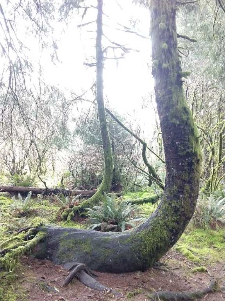
Clay soils are also more prone to erosion- soil movement, including landslides, or mass movement, of soil. An indicator of this sort of downhill movement of soil- called pistol butting – and can be observed on many forested trails in the Oregon Coast Range. If trees are growing in an area where the soil has moved, or creeped downhill, the root systems gets shifted and the trees must correct their growth to continue to reach upwards. The result is a forest of J-shaped trees. We found one example of pistol-butting during our hike.
About a mile and a half into the hike, the scenery changed. Instead of a lush conifer forest, the trail continued through a dense broadleaf riparian forest. We crossed a few bridges as we made our way over a system of streams.
Lets talk “parent material”
Looking back from the meadow toward the forests.
At this point, it might be useful to point out a bit about the geological history of Cascade Head. Cascade head is comprised of several geological units. Formed from ancient oceanic basalt volcanic rocks AND marine sedimentary rocks- like sandstone and siltstone- that were uplifted as tectonic plates collided along the western edge of North America.
When Marissa and I left the forest, and entered the open meadow that the hike is famous for, the complexity of the Cascade Head geology became clear. Looking behind us, a view of both the conifer forest and the broadleaf forest lay nicely into the background of the open meadow environment. The stark contrast between these different areas provides evidence that the geology- and soil- of each environment is unique.
Marissa explained- the basalt rocks found on Cascade Head are the base geological material- also called parent material- for the conifer forest we hiked through. Basalt rocks weather into clay soils that can retain more water than other soils, supporting large, deep rooted trees.
At the same time, sedimentary rocks weather into drier, less fertile soil, unable to support trees. The sedimentary rocks are the parent material for the meadow.
While the broadleaf forest relies on soils with properties somewhere in between.
What the ClORPT is up with Oregon soils?
Diversity of soils is not something that can only be experienced at Cascade Head. In Oregon, ten of twelve possible soil orders- the most general classification of soils- are represented in the state. The reason for the diversity of Oregon soils lies in the great variability in soil forming factors that exist across Oregon’s landscape. These factors can be remembered by the mnemonic- Cl-O-R-P-T: Climate, the presence of Organisms, Relief (or topography), Parent material, and Time.
If you consider just terrain and climate, it is easy to understand Oregon’s soil diversity. Oregon has mountains, valleys, floodplains, and more. It is both wet (in the west) and dry (in the east). Thus, the soils of one corner of the state will look completely different from another corner.
Views from the meadow
As we hiked across the meadow we could see more examples of how soil forming factors were responsible for creating the thin, rocky soils.
Sign of bioturbation from burrowing animal. Rocky meadow soil.
We saw signs of bioturbation by burrowing animals- probably gophers. Organisms, in general, are extremely important for soil formation. I hypothesized that the gophers here might help with soil formation as they would aid in mixing of organic matter into the subsoil and bringing mineral matter toward the surface where it can be weathered. However, it should be noted that too much mixing, like you see with tilled farm fields, can result in loss in soil fertility as organic matter is oxidized in the air.
As we took in the views, the wind picked up and eventually it started raining. On a coastal headland like this, erosion by wind and rain are also important factors for soil formation.
At several points along the trail, we were able to see exposed areas of rock, or parent material, where the rest of the soil had been eroded away.
Is soil like an Ogre? Does it have layers?
Cliffside at lower viewpoint- an opportunity to see soil horizons!
Eventually, we reached the lower viewpoint where you can look down a cliffside to the ocean. I asked Marissa, if she noticed anything interesting about the spot.
Looking out to the northside of the cliff, Marissa pointed out an area where you could see the soil was developing distinct layers.
You see, if you dig into the soil, you will find that it is not uniform throughout. Soil, as it forms in place, will develop layers called horizons that have unique characteristics, like color and texture.
Normally, it is difficult to observe these layers without digging into the soil. Road cuts often provide another glimpse into the world underground.
Spodosol. Photo credit NRCS.USDA.gov
The cliffside soil was in the process of developing into a spodosol, one of the twelve orders of soil. There are three main bands of color in a spodosol-see the image above. The slightly darker area in the profile is the A horizon, or topsoil; this is where all the organic matter resides making it dark. The bright red color, making up most of the image, is the B horizon, or subsoil. The E horizon is the “elluviating layer” between the A and B horizons of the soil. The minerals that give soil color, like aluminum and iron oxides, travel through this layer and settle in the B horizon below, giving it a vibrant color.
View from upper viewpoint.
From the lower viewpoint, the trail continues at a steep incline. Still out in the open, gusts of wind hurried us along the heavily eroded trail until we reached the well marked “summit.” Views are not significantly better here than the lower viewpoint. We didn’t stay long at the top before heading down the way we came.
Time to head home
Soon, we were back to the car, ready to head home.
Time is the last of the listed soil forming factors. It takes a long time to build soil- hundreds to thousands of years- it is considered nonrenewable for that very reason. For comparison sake, we completed our hike between 3-4 hours.
We exist so far outside the timescale of soil formation. Yet, soil erosion and degradation is rampant throughout the world and is happening quickly. We are losing way more soil than we are building on a daily basis.
Wait, don’t worry! All is not lost. With soil scientists, like Marissa Theve, on the case, we are getting better and better at managing our soils. We are looking at new ways to enhance soils with amendments, like biochar, and changing our practices, like farmers moving to no-till agriculture, in order to enhance and preserve soil.
As inhabitants of this planet, we can continue to make ourselves aware of our own impacts on the soil. As hikers, for example, we can stay on the trail and respect sensitive soil ecosystems.
After dropping Marissa off at her car, I drove home. My head was swimming with soil facts as I walked in the door and greeted my husband. He gave me a hug. “You smell like the Earth,” he commented. Coincidence? I think not.
Marissa Theve is a soil scientist for the BLM Northwest Oregon District. She is responsible for soils of the Cascades and Mary’s Peak resource areas. She has also worked for NRCS Soil Survey Office in Connecticut. Interview and hike with Marissa was conducted outside of working hours.