Wild about Wildlife
I love wildlife. Watching a bird on the wing or a deer bounding by makes me feel connected to, and appreciative of, the rich web of life on our planet. Wildlife encounters can also be a source of inspiration and awe. It can be a humbling experience to stand in the majesty of an animal’s presence.
However, with so many reports of negative wildlife encounters in recent years, with lives lost (both human and animal), the positive experiences of viewing wildlife are sometimes juxtaposed against a background of fear and uncertainty. The romanticized idea of wildlife and people living in harmony is exactly that- romanticized. By definition a wild animal IS wild and will behave as such.
Our Love will Survive

As human populations grow and spread more into wild places, we are encroaching into the homes of our wild neighbors. So what can we do? How can we deal with our current situation?
As I headed to the trailhead to meet Nancy Taylor, ODFW Wildlife Biologist on Valentine’s Day (nonetheless), for a hike in the McDonald-Dunn forest, these questions remained at the front of my mind. Can people and wildlife ever find love again?
Perhaps I am a romantic, but I believe the answer to that question is YES! So grab some chocolate, or your preferred hiking aphrodisiac, and join me on a hike with a wildlife biologist.
The Hike
Hike at a Glance
Trailhead: Road 540 Trailhead (Parking area right off I-5, opposite ODFW offices)
Elevation Gain: 200 ft
Miles: 3 miles
Notes: Additional parking can be found at the Peavy Arboretum Trailhead. There are many options for adding mileage to the hike. The hike takes place in the McDonald-Dunn Forests, research forest for Oregon State University. This is a popular hiking area for locals. A Map of the trail system is available online.
Blurring the Line
From the trailhead, Nancy and I headed southwest into a Douglas-fir forest chatting about what it is like to work for ODFW as a wildlife biologist.
Nancy explained that her work entails a lot of public relations and outreach. Though her primary duties are with game animals, she is often dealing with reports of wildlife sightings and alerting the public of these sightings. It has become a large part of her job over the years.
One of the reasons we chose this hike, in particular, is because the McDonald-Dunn forest has become a mecca for wildlife encounters. The Calloway Creek hike is not in a remote area. In fact, part of the trail abuts a street of homes. Yet there are countless wildlife sighting made here and warning signs posted frequently at the trailheads.
Playing Games with my Heart
Wildlife encounters near cities with lots of green space, is not surprising. Forests provide many important wildlife needs, like food, water, and shelter.
I asked Nancy how the forest we were hiking through ranked when it comes to wildlife habitat. She said it was “not bad.” With a decent amount of browse, nuts and berries it should support species like deer and wild turkey.
However, though both of us had seen turkey on the trail in the past, neither of us had seen deer in the area before. Perhaps they found better forage in nearby backyards?

In any event, it didn’t take long to spot a game trail (most likely from deer) running through the forest.
A game trail is a path created by an animal, like deer, through repeated use. Just like people, animals often follow particular paths through an area while they search for food. Even though you may not see the animal, you can gather signs that that were there. Game trails are easy to spot and can be fun to explore while on a hike, especially when the ground is soft enough to reveal the animal’s tracks.
Who are you?

On one of the game trails, Nancy and I spotted what looked like cat tracks- probably bobcat, based on their size. There were also tons of canine tracks. But they weren’t wolf or coyote- rather, domestic dog tracks. Which begs the question-Are dog tracks wildlife sign? What exactly is wildlife?
Wildlife is any non-domesticated animal- any bird, mammal, amphibian, or reptile that keeps house in the great outdoors is wildlife. Dogs, cats, cows, and most horses are NOT wildlife. But they can still be fun to look at.
Endless Love? Setting Limits.
I asked Nancy if there are certain wildlife species that are a priority for ODFW. She said that game species are the priority. Tracking elk and deer populations is necessary in order to set tag limits and manage game populations.
ODFW and other wildlife management agencies will conduct spotlight deer surveys where they drive around during certain times of the year counting animals at night when they are most active. For Elk, helicopter surveys are used for a count.
You may remember from high school Biology class that populations have a natural carrying capacity. Basically, wildlife populations are limited by their environment as resources are scarce and predators and other threats are an ever present problem. In the managed world we live in, carrying capacity has become culturally set- based on human needs and desires, as well as the health and well-being of the population. When it comes to managing wildlife populations, people are a huge part of the equation.
Roadkill
Another source of information for wildlife biologists on how wildlife is doing is roadkill. Sadly, another consequence of people moving through places that animals frequent is that they are far too often hit by cars. An Oregon law that went into effect January of 2019, makes it legal for anyone to salvage the meat of a deer or elk that was accidentally killed in a car collision . A permit must be filled with ODFW within 24 hours of when the animal is salvaged, and everything must be done according to specific guidelines. One such requirement is that the head and antlers must be turned into ODFW within 5 days of salvage. These heads then become a source of important information on wildlife for ODFW. Age can be determined by looking at the teeth of the animals. Other health conditions can also be examined.
Nancy told me she had just dissected an elk head that day to look for signs of chronic wasting disease (CWD). Caused by a prion- a misfolded protein that causes disease in the brains of animals (kinds of like mad cow), CWD creates holes in the brain tissues of elk, leading to strange behaviors, emaciation, loss of function, and even death. Though not in Oregon yet, this disease is devastating to elk populations in other areas of the country; and there is potential for spread into other animal populations as well, including humans, though no cases have been reported to date.
My Habitat is Better than yours
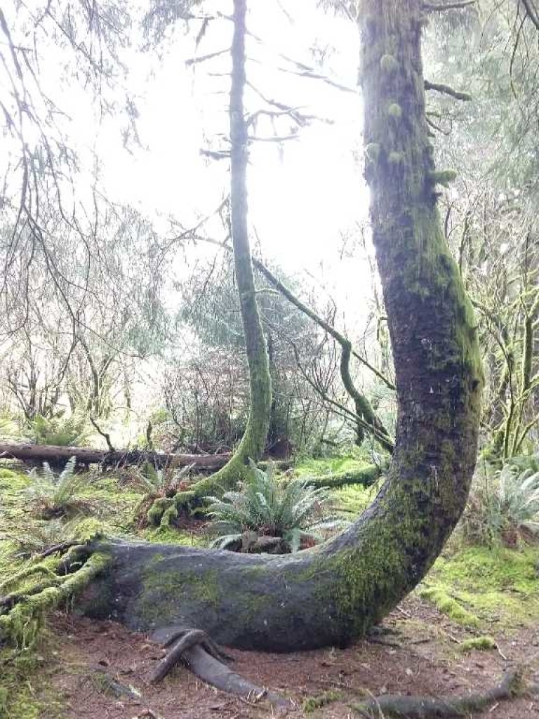
Continuing on our hike, we entered a couple of my favorite spots on this trail- 1) a mossy green riparian area dominated by big leaf maple trees and 2) an Oregon White Oak woodland further up-trail. As I paused to take in the beauty of each of these familiar spots, Nancy explained how valuable these places are for wildlife.
Riparian areas are incredibly important to wildlife, especially when you think of the disconnected landscapes that wildlife encounter with human roadways and development. Riparian areas act as natural corridors for animals to move about the landscape. They provide water and a food source for many organisms as well. Though they can make up less than 1% of the landscape, riparian areas are used by a lot of different species.

Oak woodlands are great because of their abundance of food. It is all about the nuts and berries! Wildlife signs were much more obvious and abundant when we crossed into this area. We saw holes in trees and multiple burrows with acorn shells scattered in their entryways.
Walk on by

As the trail looped back in the direction we came, we entered what looked like heavily impacted area. There were more invasive species, like Armenian blackberry, holly, and shining geranium, and the forest had less shrubs that would make good browse for deer. Invasive species, according to Nancy, are problematic for wildlife species for many reasons, they out-compete native vegetation that may be an important food source for some species, and invasives, like Armenian blackberry, can restrict movement for other species, like deer. Overall, invasive species impact on wildlife is mixed. What might not be a big deal, and perhaps help one species, can really cause problems for another.
Show ’em Some Love
As we were getting nearer to the end of the trail, I started thinking more about what might be done to resolve problems between animals and humans. I asked Nancy, what can people do to help wildlife?
With the biggest problems facing wildlife being habitat loss, Nancy recommended making this the focus.
There are many simple things people can do to get involved. Nancy suggested planting native plants that deer and elk can feed on, or putting up bird boxes, for example. Remove invasive species on your property, or get involved in a community invasive removal, or help with a native planting. Also, don’t feed wildlife directly. Dependency on humans for food is unhealthy for a wild animal.
You can also support laws and initiatives that put habitat conservation at the forefront of policy. According to Nancy, in Oregon there is a need for forestry policies that ensure better forest habitat. Nancy shared her concern regarding the loss of understory plants from plantation cuttings. Being involved in movements to improve forestry practices is another way to help on a larger scale.
Get to know ’em
More research into understanding population interactions and growth, especially for both our predatory species and game species, can also help. Understanding how animals move across the landscape through fragmented habitat can inform management decisions.
Wildlife corridors is another consideration, though an expensive one, for helping wildlife deal with our impingement into their range. At the same time, putting up fences to help keep animals off our own property can help prevent possible negative wildlife encounters.
Be Safe
Which brings me to another vital point. If we are going to rekindle our wildlife romance, we need to respect wildlife. Assume wildlife is around you, even if you don’t see it. Know what to do to be safe.
To put it in perspective, cougar populations are over 6,000 with a statewide range in Oregon. For safety, avoid being out alone during twilight hours and early morning, especially in areas that have good habitat nearby- and don’t run in these places. Even in a neighborhood setting, be alert and aware of your surroundings at times when cougars are active. If you do see a cougar, make yourself big. If you are attacked, fight back. And again, don’t run.
I’ll be Watching you

We didn’t see any cougar on the trail (though one may have seen us). However, not long before we made it back to the trailhead, movement in the trees overhead to our right caught my attention. Several birds flew across the trail, landing on some trees to the left, just ahead of where we stood. It was a varied thrush and brown creeper! This was our first and only wildlife sighting during the hike! The brown creeper entertained us for a moment by climbing up the tree trunk, while the varied thrush perched nearby showing its burnt-orange markings. Then, as quickly as they arrived, they were gone. There was no time to take a picture.
When on a trail, watching for movement, like that of our bird friends, is one of the best ways to spot wildlife. There are a lot of wildlife guides out there for those that want to identify birds or tracks/scat, but just paying attention to one’s surroundings, both sites and sounds, is a great way to start to find and appreciate wildlife. Evaluate the habitat potential for the places you frequent, as well, and be on alert in transition areas like the riparian forest or oak woodlands we saw earlier. Learn about what you might see and how this may change season to season. And if you really want to see wildlife, be out when wildlife are more active- within a few hours of dawn or sunset.
For the Love of Oregon
In the Pacific Northwest, there is no shortage of opportunities to view a variety of wildlife. Oregon has eight major ecoregions with unique flora and fauna due to its variable climate and soils. More habitat diversity means more wildlife diversity. Nancy recommends Cascade Head as a personal favorite hike for viewing wildlife- she once saw a giant pacific salamander on the trail! She also suggests heading toward the Cascade mountains for hiking. Canyon Creek Meadows is a beautiful hike near Three Fingered Jack that is recommended.
Signed, Sealed, Delivered

So get out there and enjoy some wildlife. Pay attention to your surroundings and be safe. Notice the habitat that surrounds you and, if you are so inclined, help protect and restore it. It is a privilege to have natural places near our homes and workplaces (for Nancy, nearly a stone’s throw away from her work), but it is not our space alone. Show some love for wildlife this Valentine’s day month by giving to wildlife what it needs- a little more space to call home.
Nancy Taylor has 17 years of experience working for ODFW out of the Corvallis, OR Office. She has a B.S. in Biological Sciences from Cornell and a Masters in Coastal Ecology from Louisiana State University. Much of her education and background has focused on wetland ecology and habitat conservation.